CAGAYAN DE ORO CITY, June 25, 2026 — Residents across Mindanao should remain alert for localized thunderstorms that could trigger flash floods and landslides, even as Typhoon Francisco continues moving away from the country’s southern regions, according to the latest weather bulletin issued by the Philippine Atmospheric, Geophysical and Astronomical Services Administration (PAGASA).
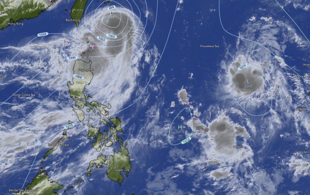
In its 5:00 a.m. regional weather forecast, PAGASA’s Mindanao Regional Services Division (MINPRSD) reported that Typhoon Francisco (international name: Mekkhala) was last located approximately 310 kilometers east-northeast of Itbayat, Batanes at 3:00 p.m. Wednesday. The typhoon was packing maximum sustained winds of 140 kilometers per hour near the center and gusts reaching up to 170 kilometers per hour while moving northward at 15 kilometers per hour.
Although the weather disturbance is far from Mindanao, PAGASA said the island region will continue to experience partly cloudy to cloudy skies with scattered rain showers and thunderstorms due to localized thunderstorm activity.
Weather forecasters warned that severe thunderstorms may bring sudden heavy rainfall capable of causing flash floods and landslides, particularly in low-lying, flood-prone, and mountainous areas.
“Possible flash floods or landslides may occur during severe thunderstorms,” PAGASA cautioned.
Rainshowers Expected Across All Mindanao Regions
The forecast covers the Zamboanga Peninsula, Northern Mindanao, Davao Region, SOCCSKSARGEN, Caraga Region, and the Bangsamoro Autonomous Region in Muslim Mindanao (BARMM), all of which are expected to experience intermittent rain showers and thunderstorms throughout the forecast period.
In the Zamboanga Peninsula, including Zamboanga City, Isabela City, and the provinces of Zamboanga del Norte, Zamboanga del Sur, and Zamboanga Sibugay, residents can expect partly cloudy skies becoming cloudy at times with rainshowers and thunderstorms. Temperatures are forecast to range between 24°C and 32°C.
Northern Mindanao provinces, including Bukidnon, Camiguin, Lanao del Norte, Misamis Occidental, and Misamis Oriental, will also experience similar weather conditions. Bukidnon is expected to record some of the coolest temperatures in the region, ranging from 22°C to 30°C.
The Davao Region, comprising Metro Davao, Davao del Norte, Davao del Sur, Davao Oriental, Davao de Oro, and Davao Occidental, will continue to experience warm and humid conditions with occasional thunderstorms. Davao Oriental is expected to register temperatures as high as 34°C, while other provinces may see highs between 32°C and 33°C.
Across SOCCSKSARGEN, including North Cotabato, South Cotabato, Sultan Kudarat, and Sarangani, scattered rain showers and thunderstorms are likewise expected. Daytime temperatures may reach up to 33°C in some areas.
The Caraga Region, covering Agusan del Norte, Agusan del Sur, Surigao del Norte, Surigao del Sur, and Dinagat Islands, will remain under partly cloudy to cloudy skies with occasional thunderstorms. Surigao del Sur may experience the highest temperature in Mindanao, reaching up to 35°C during the forecast period.
Meanwhile, provinces under BARMM, including Basilan, Sulu, Tawi-Tawi, Lanao del Sur, Maguindanao del Norte, Maguindanao del Sur, and Cotabato City, are expected to encounter the same weather pattern, with temperatures generally ranging from 22°C to 32°C.
Sea Conditions Remain Favorable
PAGASA said winds across Mindanao will remain light to moderate, blowing from the southeast to southwest. Coastal waters around most parts of the island are expected to be slight to moderate, with wave heights ranging from 0.6 to 2.1 meters.
Moderate sea conditions are expected in the waters surrounding Tawi-Tawi, while the rest of Mindanao’s coastal areas will generally experience slight to moderate seas, making conditions relatively favorable for small fishing vessels and sea travel. However, mariners are still advised to exercise caution when thunderstorms develop.
Public Advised to Stay Vigilant
PAGASA urged residents to monitor the latest weather updates, particularly in areas vulnerable to flooding and landslides. Localized thunderstorms can develop rapidly and may bring intense rainfall, lightning, and strong winds despite generally fair weather conditions earlier in the day.
Authorities also reminded the public, especially farmers, fisherfolk, motorists, and disaster response units, to remain prepared for sudden weather changes as the rainy season continues across Mindanao.
The regional forecast remains valid from 5:00 a.m. Thursday, June 25, until 5:00 a.m. Friday, June 26, 2026.