
GENERAL SANTOS CITY, Philippines — October 13, 2026 — Most parts of Mindanao are expected to experience cloudy skies, rain showers, and thunderstorms throughout Tuesday, with the Philippine Atmospheric, Geophysical and Astronomical Services Administration (PAGASA) warning that severe thunderstorms could trigger flash floods and landslides in vulnerable communities.
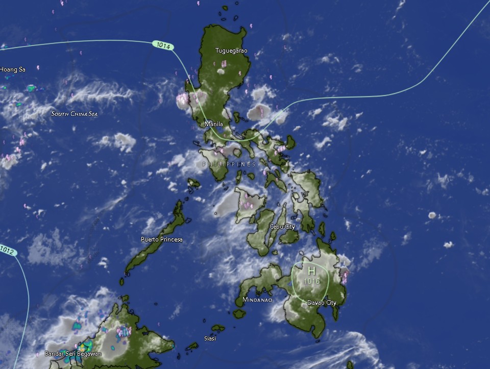
In its Regional Weather Forecast for Mindanao issued at 5:00 a.m. on October 13, PAGASA’s Mindanao station (MINPRSD) attributed the expected weather conditions to localized thunderstorms. The forecast covers the period from 5:00 a.m. Tuesday until 5:00 a.m. Wednesday, October 14.
The weather bureau said Mindanao will experience partly cloudy to cloudy skies, with isolated rain showers or thunderstorms. Although rainfall may be intermittent, residents are advised to remain alert because thunderstorms can bring sudden, intense downpours that may cause flooding in low-lying areas and landslides in communities near steep slopes.
PAGASA also forecast light to moderate winds coming from the southeast to east across Mindanao, with slight to moderate sea conditions and wave heights ranging from 0.6 to 1.8 meters.
Cloudy skies and thunderstorms across Northern Mindanao, Zamboanga Peninsula
The Zamboanga Peninsula is expected to experience cloudy skies with rain showers and thunderstorms, including Zamboanga City and the provinces of Zamboanga del Norte, Zamboanga del Sur, and Zamboanga Sibugay. Similar conditions are forecast for Isabela City.
Temperatures in the area are expected to range from 24°C to 34°C, depending on the locality and forecast period. Winds will generally be light to moderate, with directions varying from southwest to south, southwest to southeast, or southeast to east.
In Northern Mindanao, cloudy skies with rain showers and thunderstorms are forecast in Bukidnon, Camiguin, Lanao del Norte, Misamis Occidental, and Misamis Oriental.
Bukidnon is expected to record temperatures of 20°C to 31°C, while Camiguin may experience temperatures of 25°C to 31°C. Lanao del Norte, Misamis Occidental, and Misamis Oriental are forecast to have temperatures generally ranging from 25°C to 32°C.
Residents in flood-prone communities and areas with a history of rain-induced landslides should monitor local conditions, particularly during periods of persistent or heavy rainfall.
Davao Region to experience intermittent rain and thunderstorms
Across the Davao Region, Metro Davao, Davao del Norte, Davao del Sur, Davao Oriental, Davao de Oro, and Davao Occidental are expected to experience partly cloudy skies that may become cloudy at times, accompanied by rain showers or thunderstorms.
Forecast temperatures in Metro Davao and the provinces of Davao del Norte, Davao del Sur, and Davao Oriental are expected to range from 25°C to 33°C. Davao de Oro and Davao Occidental may experience temperatures between 23°C and 35°C.
Winds are generally expected to be light to moderate from the southeast to east, although moderate winds were indicated for Davao del Sur during the earlier forecast period.
The combination of warm daytime temperatures and localized thunderstorms means residents may experience changing weather conditions throughout the day. Motorists should exercise caution on wet roads, while outdoor workers, commuters, and people participating in outdoor activities should watch for developing thunderstorms.
Communities near rivers, creeks, drainage channels, and steep terrain should also remain vigilant for sudden changes in water levels and possible slope instability.
SOCCSKSARGEN expects scattered periods of rain
The provinces of North Cotabato, South Cotabato, Sultan Kudarat, and Sarangani are forecast to experience partly cloudy skies to cloudy conditions at times, with rain showers or thunderstorms.
Temperatures across much of SOCCSKSARGEN are expected to range from 24°C to 32°C during the forecast period. Winds will generally be light to moderate from the southeast to east.
While the forecast does not indicate continuous rainfall throughout the region, localized thunderstorms may produce heavy rain over particular communities even when nearby areas experience relatively fair weather.
Residents in low-lying neighborhoods and communities near waterways should remain alert for possible flooding, especially where drainage systems are inadequate or rivers and creeks respond quickly to heavy rainfall.
Farmers, fisherfolk, construction workers, and other outdoor workers are advised to take weather conditions into account when planning their activities.
Caraga faces cloudy skies and thunderstorms
Cloudy skies with rain showers and thunderstorms are forecast across the Caraga Region, including Agusan del Norte, Agusan del Sur, Surigao del Norte, Surigao del Sur, and the Dinagat Islands.
Temperatures are expected to range from 24°C to 34°C across the region, depending on the province and forecast period. Winds will generally be light to moderate from the southeast to east.
The expected thunderstorms warrant particular attention in communities near rivers, creeks, and mountainous or landslide-prone areas. Heavy rainfall over a short period can cause rapid runoff, flooding, and slope failures, even if rainfall is not widespread throughout the region.
Coastal communities and those planning sea travel should also consider the forecast of slight to moderate sea conditions and check for any subsequent marine advisories before departure.
BARMM provinces and island communities also expect thunderstorms
In the Bangsamoro Autonomous Region in Muslim Mindanao (BARMM), cloudy skies with rain showers and thunderstorms are expected in Basilan, Lanao del Sur, Sulu, and Tawi-Tawi.
Cotabato City is forecast to experience partly cloudy skies that may become cloudy at times, with rain showers or thunderstorms. Maguindanao del Norte and Maguindanao del Sur may initially experience partly cloudy conditions before shifting to cloudy skies with rain showers and thunderstorms during the daytime forecast period.
Temperatures are expected to range from 22°C to 33°C across the listed BARMM areas.
Winds are forecast to remain generally light to moderate from the southeast to east, while coastal waters are expected to have slight to moderate conditions in the listed coastal areas.
Residents in flood-prone communities, particularly those near waterways and low-lying settlements, should remain alert for heavy downpours. Fisherfolk and small-craft operators are advised to monitor local sea conditions and heed instructions from authorities.
PAGASA urges caution amid possible flash floods and landslides
PAGASA’s principal warning for the forecast period is the possibility of flash floods and landslides due to severe thunderstorms.
Localized thunderstorms can develop quickly and produce intense rainfall over limited areas. As a result, flooding may occur in one community while nearby locations experience little or no rain.
Residents are advised to monitor official weather bulletins and announcements from their local disaster risk reduction and management offices. Those living near rivers, creeks, drainage channels, and steep slopes should be prepared to move to safer locations if conditions deteriorate or evacuation advisories are issued.
Motorists should slow down on rain-soaked roads, avoid crossing flooded streets and waterways, and watch for falling branches, poor visibility, and possible landslides. Residents should also avoid open fields, exposed hilltops, and other unsafe locations during thunderstorms, and stay away from trees and isolated structures that offer little protection from lightning.
Fisherfolk and other people traveling by sea should check updated marine advisories before departure, as weather and sea conditions may change.
PAGASA emphasized that the regional forecast provides an outlook for expected weather conditions, while actual rainfall and thunderstorm activity may vary by locality. Residents are encouraged to follow updated bulletins from PAGASA and local authorities for the latest warnings and possible changes in conditions.