
The Intertropical Convergence Zone (ITCZ) will continue to affect Mindanao, bringing cloudy skies, rainshowers and thunderstorms across several areas on Sunday, September 27, 2026, according to the latest regional weather forecast issued by the Philippine Atmospheric, Geophysical and Astronomical Services Administration (PAGASA) Mindanao Regional Services Division (MINPRSD).
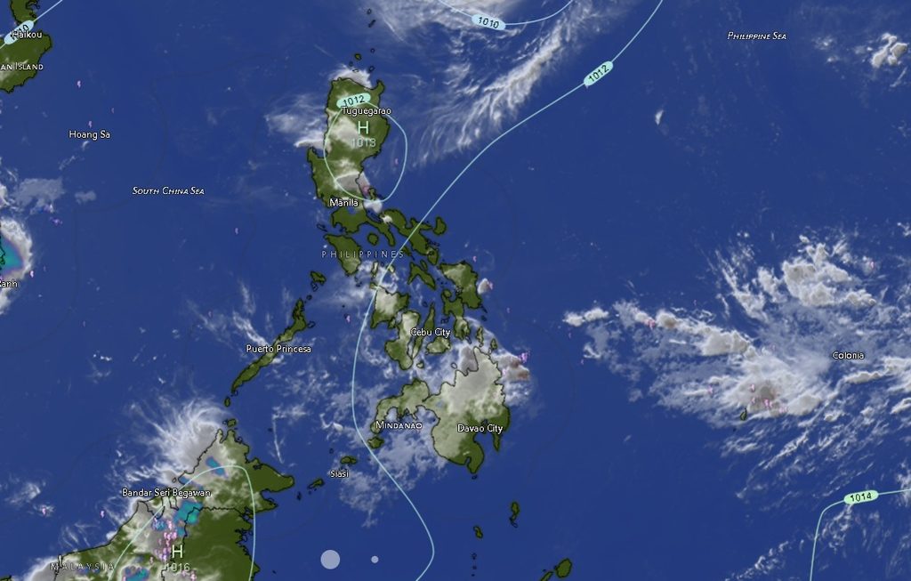
The forecast, issued at 5:00 AM on September 27, is valid from 5:00 AM Sunday until 5:00 AM Monday.
At 3:00 PM Saturday, September 26, the center of Severe Tropical Storm Queenie was estimated, based on available data, at about 600 kilometers east of Itbayat, Batanes, near 23.1°N, 127.1°E. Queenie had maximum sustained winds of 110 kilometers per hour near its center and gustiness of up to 135 kph.
The storm was moving northward at 15 kph at the time of the observation.
ITCZ Keeps Several Mindanao Areas Under Rain Threat
PAGASA said the ITCZ will bring cloudy skies with scattered rains and thunderstorms over the Zamboanga Peninsula, Bangsamoro Autonomous Region in Muslim Mindanao (BARMM), Northern Mindanao, Caraga, North Cotabato and Davao Oriental.
The agency warned that flash floods and landslides are possible, particularly in areas that receive moderate to at times heavy rainfall.
The rest of Mindanao is expected to experience partly cloudy to cloudy skies with isolated rainshowers and thunderstorms. PAGASA cautioned that severe thunderstorms could also trigger flash floods or landslides.
Residents in flood- and landslide-prone communities are advised to remain alert, particularly during periods of persistent or heavy rainfall.
Rainy Conditions Expected Across Western and Northern Mindanao
In the Zamboanga Peninsula, Zamboanga City, Zamboanga del Norte, Zamboanga del Sur, Zamboanga Sibugay and Isabela City are forecast to experience cloudy skies with rainshowers and thunderstorms.
Temperatures in the peninsula are expected to range from the low to mid-20s to the low 30s Celsius, with Zamboanga City reaching as high as 33°C during the daytime period.
Northern Mindanao will also remain generally wet, with Bukidnon, Camiguin, Lanao del Norte, Misamis Occidental and Misamis Oriental expected to experience cloudy conditions with rainshowers and thunderstorms.
Bukidnon may record temperatures between 21°C and 32°C, while Misamis Oriental could reach 32°C.
Davao Region Faces Thunderstorms
In the Davao Region, Metro Davao, Davao del Norte, Davao del Sur, Davao Oriental, Davao de Oro and Davao Occidental will experience partly cloudy to at times cloudy skies, with rainshowers or thunderstorms expected in several areas.
Davao Oriental will have cloudier conditions with rainshowers and thunderstorms and temperatures ranging from 22°C to 31°C.
Davao de Oro could reach 34°C, the highest forecast maximum temperature in the Davao Region, while Davao del Norte could reach 33°C.
Caraga, SOCCSKSARGEN Also Expect Rain
Cloudy skies with rainshowers and thunderstorms are expected across much of Caraga, including Agusan del Norte, Agusan del Sur, Surigao del Norte, Surigao del Sur and Dinagat Islands.
Daytime temperatures could reach 35°C in Surigao del Norte, while Agusan del Norte and Agusan del Sur could reach 34°C.
In SOCCSKSARGEN, North Cotabato is expected to have cloudy skies with rainshowers and thunderstorms, while South Cotabato, Sultan Kudarat and Sarangani may experience partly cloudy to at times cloudy skies with rainshowers or thunderstorms.
Temperatures could reach 32°C in North Cotabato, South Cotabato and Sarangani, while Sultan Kudarat could reach 32°C.
BARMM Areas to See Rainshowers and Thunderstorms
Several areas of the BARMM will also remain affected by the ITCZ.
Cotabato City, Basilan, Maguindanao del Sur and Tawi-Tawi are expected to experience cloudy skies with rainshowers and thunderstorms. Lanao del Sur, Maguindanao del Norte and Sulu may have partly cloudy to at times cloudy conditions, with rainshowers or thunderstorms developing.
Temperatures across the BARMM are generally expected to remain in the 23°C to 34°C range, depending on location and time of day.
Winds and Coastal Conditions
PAGASA said light to moderate winds from the south to southwest will prevail across Mindanao, while coastal waters will generally be slight to moderate, with wave heights ranging from 0.6 to 1.5 meters.
Despite generally manageable sea conditions, fishermen, boat operators and other coastal communities are advised to monitor weather conditions, particularly when thunderstorms develop.
The combination of the ITCZ and locally generated thunderstorms may result in sudden changes in weather, including periods of heavy rain, gusty winds and reduced visibility.
PAGASA advised the public to continue monitoring official weather bulletins and local government advisories, especially those in communities vulnerable to flash floods and landslides.