
Cloudy skies accompanied by scattered rains and thunderstorms are expected to prevail across Mindanao from Tuesday morning until Wednesday morning as the trough of a low-pressure area continues to affect the region, according to the Philippine Atmospheric, Geophysical and Astronomical Services Administration (PAGASA).
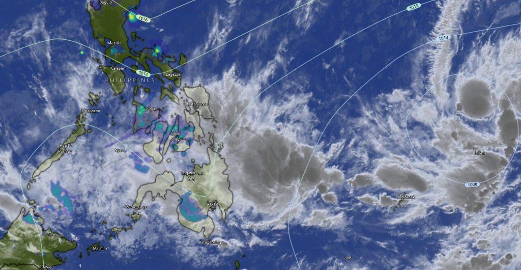
In its regional weather forecast issued at 5:00 a.m. on March 10, the weather bureau said the trough of the LPA will bring unstable weather conditions throughout Mindanao, with moderate to occasionally heavy rainfall that could trigger flash floods and landslides, particularly in low-lying and mountainous areas.
PAGASA warned that residents, especially those living near rivers and landslide-prone areas, should remain vigilant as prolonged rainfall may increase the risk of flooding and soil erosion.
Winds and Sea Conditions
The eastern section of Mindanao, including parts of the Caraga and Davao regions, is expected to experience moderate to strong winds coming from the northeast to north. These conditions may result in moderate to rough seas, with wave heights ranging from 1.5 to 3.4 meters.
Meanwhile, the rest of Mindanao will have light to moderate winds from the northeast to north, bringing slight to moderate sea conditions with wave heights between 0.6 and 2.5 meters.
Fisherfolk and small sea vessels are advised to exercise caution when venturing into the sea, particularly in eastern coastal areas where stronger winds and higher waves are expected.
Weather Conditions by Region
Across the Zamboanga Peninsula, including Zamboanga City and the provinces of Zamboanga del Norte, Zamboanga del Sur, and Zamboanga Sibugay, cloudy skies with rain showers and thunderstorms are forecast throughout the day. Temperatures are expected to range between 23°C and 31°C, accompanied by light to moderate winds and slight to moderate coastal waters.
In Northern Mindanao, provinces such as Bukidnon, Camiguin, Lanao del Norte, Misamis Occidental, and Misamis Oriental will also experience cloudy skies with rain showers and thunderstorms. Temperatures are forecast to range between 19°C and 30°C.
Similar weather conditions are expected in the Davao Region, including Davao del Norte, Davao del Sur, Davao Oriental, Davao de Oro, Davao Occidental, and Metro Davao. Temperatures across these areas will range from 23°C to 32°C, with stronger winds and rougher seas expected along the eastern coastline.
In SOCCSKSARGEN, the provinces of North Cotabato, South Cotabato, Sultan Kudarat, and Sarangani will experience cloudy weather with rain showers and thunderstorms, with temperatures between 23°C and 31°C.
The Caraga Region, covering Agusan del Norte, Agusan del Sur, Surigao del Norte, Surigao del Sur, and Dinagat Islands, is expected to experience stronger winds and moderate to rough sea conditions due to its exposure to the northeast wind flow.
Meanwhile, areas under the Bangsamoro Autonomous Region in Muslim Mindanao (BARMM) such as Cotabato City, Basilan, Lanao del Sur, Sulu, Tawi-Tawi, Maguindanao del Norte, and Maguindanao del Sur will also experience similar weather conditions with temperatures ranging from 21°C to 32°C.
Public Advisory
PAGASA urged residents to stay updated on weather bulletins and advisories, especially communities vulnerable to flooding and landslides.
Local disaster risk reduction offices are also encouraged to monitor weather developments closely and prepare for possible weather-related incidents as the trough of the LPA continues to influence weather patterns across Mindanao over the next 24 hours.