
October 18, 2026 | The Mindanao Sentinel
Mindanao is expected to experience cloudy skies with scattered rain showers and thunderstorms throughout Sunday and into early Monday, October 19, as the Intertropical Convergence Zone (ITCZ) continues to influence the region, according to the Philippine Atmospheric, Geophysical and Astronomical Services Administration (PAGASA).
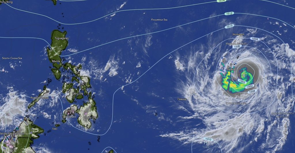
In its Regional Weather Forecast for Mindanao (MINPRSD), issued at 5:00 a.m. on October 18 and valid until 5:00 a.m. on October 19, PAGASA warned that moderate to occasionally heavy rainfall could trigger flash floods and landslides in vulnerable areas.
Residents living near rivers and creeks, in low-lying communities, and along steep or landslide-prone slopes were advised to remain alert for changing weather conditions, particularly during periods of persistent or intense rainfall.
The forecast covers the Zamboanga Peninsula, Northern Mindanao, Davao Region, SOCCSKSARGEN, Caraga, and the Bangsamoro Autonomous Region in Muslim Mindanao (BARMM), indicating that rain showers and thunderstorms are expected across the island.
ITCZ to sustain unsettled weather
The ITCZ, a zone where winds converge and encourage the development of clouds and rain-producing weather systems, is identified by PAGASA as the prevailing weather system affecting Mindanao.
Under the forecast, cloudy skies with rain showers and thunderstorms are expected across the provinces and cities covered by the regional bulletin. Although rainfall intensity and timing may vary from one locality to another, the possibility of moderate to occasionally heavy rain raises concerns about localized flooding and rain-induced landslides.
Communities should not assume that conditions will remain safe simply because rainfall is light or absent in their immediate area. Heavy rain elsewhere in a river basin can contribute to rising water levels downstream, while saturated soil can increase the risk of slope failure.
PAGASA’s regional forecast does not specify particular communities where flooding or landslides will occur. The warning identifies these hazards as possible consequences of moderate to occasionally heavy rainfall.
Zamboanga Peninsula: Rain showers and thunderstorms expected
Zamboanga City, Zamboanga del Norte, Zamboanga del Sur, Zamboanga Sibugay, and Isabela City are all forecast to experience cloudy skies with rain showers and thunderstorms.
Temperatures in Zamboanga City are expected to range from 25°C to 32°C in the morning forecast period, while Zamboanga del Norte may reach 33°C. Zamboanga del Sur and Zamboanga Sibugay are forecast to have temperatures between 25°C and 32°C.
Isabela City is expected to have cooler conditions, with temperatures ranging from 25°C to 29°C during the period covered by the bulletin.
Winds across the peninsula are forecast to be light to moderate, generally coming from the southeast to northeast. Coastal waters are expected to range from slight to moderate.
Northern Mindanao: Thunderstorms across five areas
Bukidnon, Camiguin, Lanao del Norte, Misamis Occidental, and Misamis Oriental are likewise expected to experience cloudy skies with rain showers and thunderstorms.
Bukidnon is forecast to have temperatures between 23°C and 30°C, while Camiguin may experience temperatures from 24°C to 29°C.
Lanao del Norte is expected to be relatively cooler, with temperatures ranging from 22°C to 26°C. Misamis Occidental and Misamis Oriental are both forecast to experience temperatures between 25°C and 29°C.
The regional outlook calls for light to moderate winds in most areas, generally from the southeast to northeast, with slight to moderate coastal conditions.
Residents in upland and mountainous communities, particularly those near steep slopes and areas with a history of landslides, should remain cautious when heavy rain develops.
Davao Region: Rain and thunderstorms from Davao City to Davao Occidental
Cloudy skies with rain showers and thunderstorms are forecast across Metro Davao, Davao del Norte, Davao del Sur, Davao Oriental, Davao de Oro, and Davao Occidental.
For Metro Davao, temperatures are expected to range from 25°C to 31°C during the initial forecast period. Davao del Norte may experience temperatures between 24°C and 30°C, while Davao del Sur and Davao Oriental are forecast to have temperatures ranging from 23°C to 32°C.
Davao de Oro is expected to experience temperatures between 23°C and 31°C, while Davao Occidental may record temperatures from 25°C to 30°C.
The forecast indicates light to moderate winds from the southeast to northeast and slight to moderate coastal conditions.
Rainfall may affect road travel, outdoor activities, and communities situated near waterways. Motorists should exercise caution on roads where heavy rain reduces visibility or causes water to accumulate.
Fisherfolk and other people working at sea should also monitor local marine conditions before departing, particularly as coastal waters may become moderate in some areas.
SOCCSKSARGEN: Thunderstorms expected across five areas
North Cotabato, South Cotabato, Sultan Kudarat, Sarangani, and General Santos City’s surrounding regional area are covered by the forecast for SOCCSKSARGEN.
North Cotabato and South Cotabato are expected to experience temperatures between 24°C and 31°C during the initial forecast period. Sultan Kudarat is forecast to have temperatures ranging from 26°C to 29°C, while Sarangani may experience temperatures between 25°C and 29°C.
All five areas are covered by the regional outlook for cloudy skies with rain showers and thunderstorms.
Light to moderate winds from the southeast to northeast are expected, with slight to moderate coastal conditions.
Residents in flood-prone communities should pay attention to rainfall accumulation and changing water levels, especially during prolonged thunderstorms. Those travelling through hilly or mountainous areas should also be alert for possible landslides and debris on roads.
Caraga: Rain showers expected across all provinces
The forecast covers Agusan del Norte, Agusan del Sur, Surigao del Norte, Surigao del Sur, and the Dinagat Islands, with cloudy skies, rain showers, and thunderstorms expected throughout the forecast period.
Agusan del Norte and Agusan del Sur are forecast to experience temperatures between 25°C and 32°C. Surigao del Norte may record temperatures ranging from 26°C to 30°C, while Surigao del Sur is expected to have temperatures between 23°C and 30°C.
The Dinagat Islands are forecast to experience temperatures from 25°C to 30°C.
Light to moderate winds from the southeast to northeast are expected, with slight to moderate coastal conditions.
The combination of thunderstorms and potentially heavy rainfall means communities near waterways and landslide-prone terrain should remain vigilant. People travelling by land or sea should check conditions before setting out and avoid exposed areas during thunderstorms.
BARMM: Rain and thunderstorms forecast from Basilan to Tawi-Tawi
Cloudy skies with rain showers and thunderstorms are also expected across the BARMM areas included in the regional bulletin: Cotabato City, Basilan, Lanao del Sur, Sulu, Tawi-Tawi, Maguindanao del Norte, and Maguindanao del Sur.
Cotabato City is forecast to experience temperatures between 25°C and 31°C during the initial period, while Basilan may record temperatures ranging from 24°C to 31°C.
Lanao del Sur is expected to have temperatures between 23°C and 30°C. Sulu may experience temperatures from 25°C to 33°C, while Tawi-Tawi is forecast to have temperatures between 26°C and 30°C.
Maguindanao del Norte and Maguindanao del Sur are expected to be among the warmer areas in the forecast, with temperatures ranging from 25°C to 34°C.
Winds are forecast to be light to moderate and generally from the southeast to northeast, with slight to moderate coastal conditions.
Residents should remain alert to possible flooding and landslides associated with moderate to occasionally heavy rainfall. Those in coastal communities should monitor local sea conditions, particularly when thunderstorms affect their area.
Coastal waters generally slight to moderate
PAGASA’s regional outlook indicates slight to moderate coastal conditions across the covered areas, with the broader Mindanao forecast placing sea conditions at approximately 0.6 to 1.8 meters.
Winds are expected to be light and variable in the general regional outlook, while individual provincial forecasts commonly indicate light to moderate winds from the southeast to northeast.
Although the forecast does not indicate uniformly rough seas, conditions can vary by location and may change during thunderstorms. Fisherfolk, boat operators, and passengers on small vessels should check the latest local marine advisories and exercise caution when weather deteriorates.
Public urged to prepare for possible flooding and landslides
With the ITCZ expected to bring widespread unsettled weather, residents are advised to take practical precautions before and during periods of heavy rainfall.
These include monitoring official weather updates, clearing drainage channels where safe, avoiding flooded roads and fast-flowing waterways, and staying away from slopes showing signs of instability.
Residents should also be alert to rapidly rising streams, unusual water flow, ground cracks, falling rocks, or other signs of possible landslides. Anyone in immediate danger should move to a safer location and follow instructions from local disaster risk reduction and management offices.
PAGASA emphasized in its regional forecast that flash floods and landslides are possible due to moderate to occasionally heavy rains. The advisory does not establish that these hazards will occur in every locality, but it highlights the need for preparedness across the affected areas.
The forecast was issued by PAGASA’s Mindanao Regional Services Division (MINPRSD) at 5:00 a.m. on October 18, 2026, and is valid until 5:00 a.m. on October 19.
For further information, the public may consult PAGASA’s official website at https://bagong.pagasa.dost.gov.ph/ or contact the agency through the telephone numbers listed in its regional forecast.