
CAGAYAN DE ORO CITY, Philippines — Large parts of Mindanao are expected to experience unstable weather conditions over the next 24 hours, with state weather bureau Philippine Atmospheric, Geophysical and Astronomical Services Administration attributing the conditions to prevailing easterlies affecting the region.
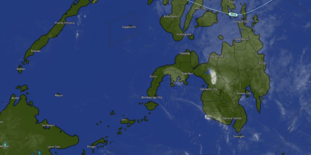
In its latest regional weather forecast issued at 5:00 a.m. Saturday, PAGASA reported that the Caraga region and Davao Oriental will see cloudy skies with scattered rains and thunderstorms, while the rest of Mindanao will experience partly cloudy to cloudy skies with isolated rain showers or thunderstorms.
Rainfall Concentrated in Eastern Mindanao
The weather disturbance is expected to be more pronounced in eastern sections, particularly in Caraga and Davao Oriental, where intermittent rains and thunderstorms may persist throughout the day and into early Sunday.
Areas under Caraga—including Agusan del Norte, Agusan del Sur, Surigao del Norte, Surigao del Sur, and Dinagat Islands—are forecast to have generally cloudy skies with frequent rain showers and thunderstorms, raising concerns over localized weather disturbances.
PAGASA warned that severe thunderstorms could trigger flash floods or landslides, especially in low-lying and mountainous areas.
Fair Weather with Isolated Rains Elsewhere
The rest of Mindanao, including Northern Mindanao, Zamboanga Peninsula, SOCCSKSARGEN, BARMM, and most parts of the Davao Region, will experience generally fair weather conditions, though occasional downpours and thunderstorms are still expected.
Metro Davao and nearby provinces will see temperatures ranging from 24°C to 34°C, while inland areas such as Bukidnon may experience slightly cooler conditions, with temperatures dipping to as low as 20°C.
In the Zamboanga Peninsula, including Zamboanga City, Zamboanga del Norte, Zamboanga del Sur, and Zamboanga Sibugay, temperatures are expected to range between 23°C and 35°C, accompanied by intermittent rain showers.
Light to Moderate Winds, Manageable Sea Conditions
Across Mindanao, winds will remain light to moderate, blowing from the northeast to north. Coastal waters will be slight to moderate, with wave heights ranging from 0.6 to 2.1 meters, making conditions generally manageable for small fishing vessels but still requiring caution during thunderstorms.
Advisory for Residents and Travelers
Authorities are urging residents, particularly those in landslide- and flood-prone areas, to stay alert as weather conditions may rapidly change during thunderstorms. Fisherfolk and small seacraft operators are likewise advised to monitor updates before heading out to sea.
PAGASA continues to monitor the situation and encourages the public to stay informed through official weather bulletins and advisories.
The current forecast remains valid until 5:00 a.m. Sunday, March 22, 2026.