
GENERAL SANTOS CITY, Philippines — Most parts of Mindanao will experience partly cloudy to cloudy skies with isolated rain showers or localized thunderstorms over the next 24 hours, with the possibility of flash floods and landslides during severe thunderstorms, according to the Philippine Atmospheric, Geophysical and Astronomical Services Administration (PAGASA).
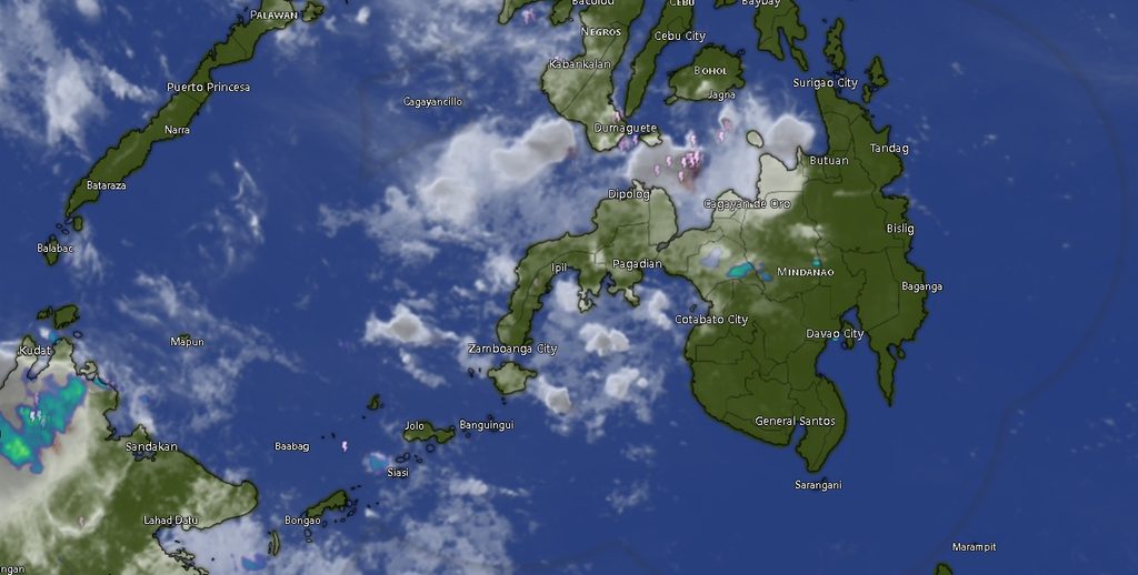
In its regional weather forecast issued at 5:00 a.m. on Monday, November 2, 2026, PAGASA’s Mindanao office (MINPRSD) said the prevailing weather conditions would bring generally fair periods interrupted by localized rain showers and thunderstorms across the island.
The forecast is valid from 5:00 a.m. Monday until 5:00 a.m. Tuesday, November 3.
PAGASA cautioned residents, particularly those living in low-lying and flood-prone communities and areas vulnerable to landslides, to remain alert during thunderstorms, when heavy rainfall could trigger sudden flooding and slope failures.
East to southeast winds, moderate coastal conditions
Winds across Mindanao are expected to remain light to moderate, coming from the east to southeast.
Coastal waters will generally range from slight to moderate, with wave heights estimated at 0.6 to 2.5 meters. While these conditions are generally less disruptive than rough-sea conditions, fishing communities, small fishing vessels and other marine operators are advised to exercise caution, particularly during passing thunderstorms.
Temperature outlook across Mindanao
In the Zamboanga Peninsula, Zamboanga City and Zamboanga del Norte are forecast to experience temperatures of 24°C to 32°C during the initial forecast period, while Zamboanga del Sur will have temperatures ranging from 23°C to 31°C. Zamboanga Sibugay is expected to record 24°C to 32°C, while Isabela City will have temperatures between 25°C and 31°C.
Temperatures are expected to climb during the following daytime period, reaching as high as 34°C in Zamboanga City and Zamboanga del Norte.
Across Northern Mindanao, Bukidnon will have relatively cooler conditions, with temperatures ranging from 18°C to 31°C. Camiguin is forecast to experience 25°C to 32°C, while Lanao del Norte, Misamis Occidental and Misamis Oriental will have temperatures generally ranging from 25°C to 30°C.
In the Davao Region, Metro Davao, Davao del Norte and Davao del Sur are expected to record temperatures of 24°C to 31°C. Davao Oriental will have slightly cooler conditions, with temperatures between 23°C and 30°C.
Meanwhile, Davao de Oro and Davao Occidental are forecast to experience temperatures of 23°C to 30°C during the initial period.
SOCCSKSARGEN and Caraga brace for localized thunderstorms
In SOCCSKSARGEN, North Cotabato is expected to experience temperatures of 21°C to 31°C, while South Cotabato will have temperatures ranging from 23°C to 32°C. Sultan Kudarat is forecast to record 24°C to 31°C, while Sarangani will have temperatures between 26°C and 30°C.
For Caraga, Agusan del Norte is expected to experience temperatures of 24°C to 32°C, while Agusan del Sur will have temperatures ranging from 22°C to 32°C.
Surigao del Norte is forecast to record 26°C to 31°C, Surigao del Sur 24°C to 31°C, and Dinagat Islands 25°C to 31°C.
Temperatures across several of these provinces may rise by Tuesday afternoon, with some areas expected to reach 34°C.
BARMM also likely to experience rain showers
The Bangsamoro Autonomous Region in Muslim Mindanao (BARMM) will likewise experience partly cloudy to cloudy skies with isolated rain showers or thunderstorms.
Cotabato City is forecast to have temperatures of 25°C to 31°C, while Basilan will range from 25°C to 31°C. Lanao del Sur is expected to experience cooler conditions, with temperatures between 20°C and 29°C.
Sulu and Tawi-Tawi will have temperatures ranging from 24°C to 31°C and 25°C to 31°C, respectively. Maguindanao del Norte is forecast to record 23°C to 32°C, while Maguindanao del Sur will have temperatures between 23°C and 32°C.
Daytime temperatures in several BARMM provinces may reach 33°C by Tuesday.
Residents urged to remain alert
Although no widespread weather disturbance was identified in the regional forecast, PAGASA’s warning on possible flash floods and landslides highlights the risks associated with localized thunderstorms.
Residents are advised to monitor weather developments, avoid crossing swollen rivers and flooded waterways, and remain cautious in mountainous and landslide-prone areas during periods of heavy rainfall.
Fisherfolk and operators of small seacraft should also monitor local marine conditions and avoid venturing into the waters when thunderstorms develop.
For weather updates and further information, the public may visit PAGASA’s official website at bagong.pagasa.dost.gov.ph or contact its Mindanao office in El Salvador City, Misamis Oriental, through (02) 8927-1335.
The regional forecast was prepared by PAGASA’s Mindanao office under the Department of Science and Technology (DOST).