The powerful magnitude 7.8 earthquake that struck off the coast of Sarangani on June 8 has dramatically altered portions of Mindanao’s southern coastline, with government scientists confirming a significant coastal uplift that raised sections of the seabed by as much as two meters and pushed the shoreline hundreds of meters seaward.
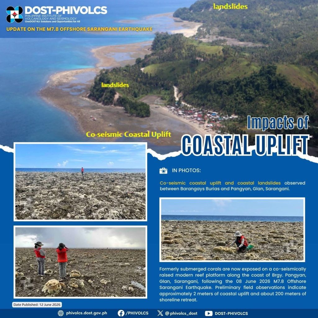
The geological transformation, observed in parts of Glan, Sarangani Province, and extending to areas of Jose Abad Santos, Davao Occidental, has exposed vast stretches of coral reefs and seagrass beds that were previously submerged beneath seawater, raising concerns over ecological damage and long-term impacts on coastal communities.
Initial reports from residents in Glan emerged on June 10, when locals noticed that sea levels remained unusually low and had not returned to their normal state days after the earthquake. The unusual phenomenon prompted the Sarangani Bay Protected Seascape (SBPS) Protected Area Management Office (PAMO) and the Community Environment and Natural Resources Office (CENRO) in Glan to conduct ground validation despite damaged roads and difficult access conditions caused by the earthquake.
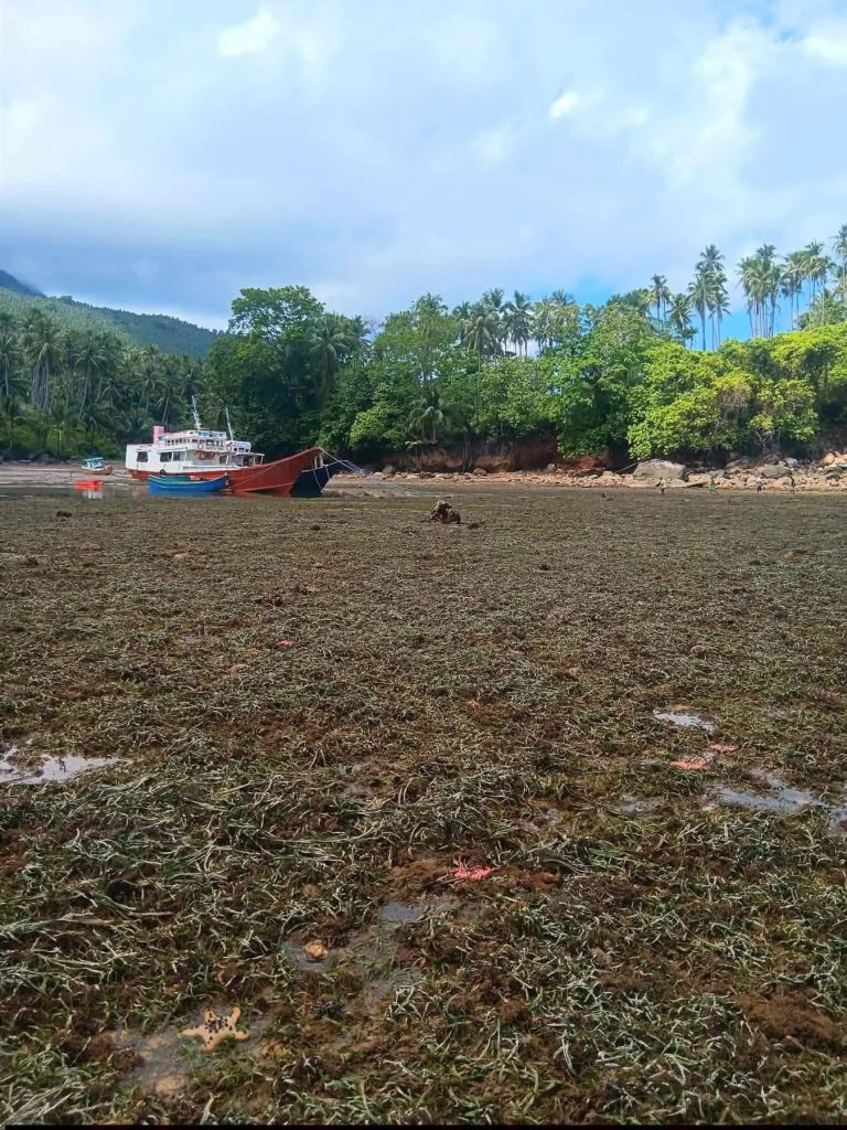
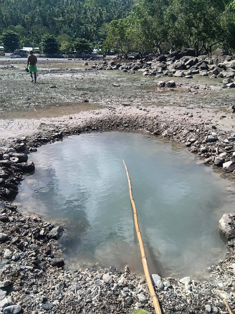
Field teams discovered extensive areas of exposed marine habitats, particularly within the Pangyan Marine Sanctuary in Barangay Pangyan, Glan. Coral reefs, seagrass beds, and marine organisms that once thrived underwater were left stranded above the surface.
Among the affected marine life were reef fish, eels, clams, shells, and other coastal species that depend on constant submersion for survival. Conservation personnel reported that many of these organisms had already begun dying due to prolonged exposure to sunlight and air.
Residents living near the affected shoreline expressed concern over the foul odor emanating from decaying marine life. Some feared that the stench and deteriorating environmental conditions could pose health risks to nearby communities.
Scientific confirmation of the coastal uplift came on June 11 through an aerial survey and ground assessment conducted jointly by the Department of Science and Technology–Philippine Institute of Volcanology and Seismology (DOST-PHIVOLCS) and the Mines and Geosciences Bureau (MGB) Region XII.
The survey documented co-seismic coastal uplift—an abrupt rise of land caused directly by tectonic movement during an earthquake—in several coastal areas of Glan and the southern portions of Sarangani Province, as well as in parts of Jose Abad Santos, Davao Occidental.
According to PHIVOLCS and MGB scientists, the seabed in Barangay Pangyan rose by approximately two meters, causing the shoreline to retreat by an estimated 200 meters. Areas that were once underwater are now dry land, fundamentally changing the shape of the coastline.
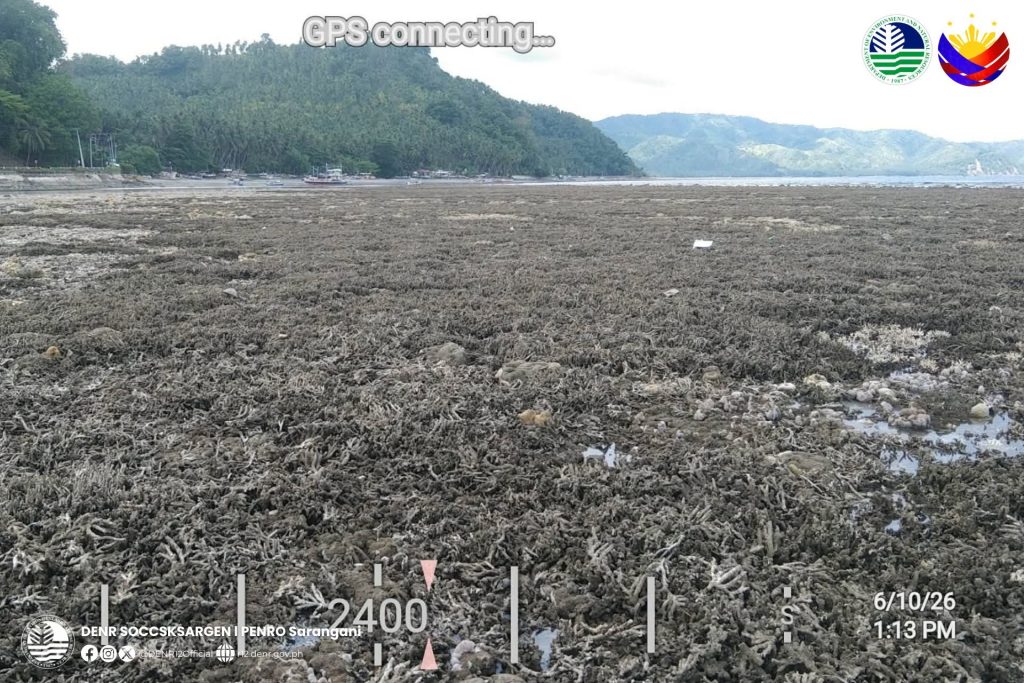
Aerial images captured during the survey revealed exposed coral formations stretching far beyond the current waterline, providing striking visual evidence of the immense geological forces unleashed by the earthquake.
The coastal uplift was accompanied by reports of landslides in several areas, underscoring the widespread impact of the earthquake across southern Mindanao.
Environmental experts warn that while coastal uplift is a natural consequence of major tectonic events, it can have severe ecological consequences. Coral reefs and seagrass ecosystems serve as critical habitats for fish populations, breeding grounds for marine species, and natural barriers that protect coastlines from erosion and storm surges.
The sudden exposure of these ecosystems threatens biodiversity and may affect local fisheries that many coastal communities rely on for food and livelihood.
Beyond environmental concerns, scientists are also studying the long-term implications of the uplift on navigation routes, coastal infrastructure, fisheries, and future coastal development. Changes in seabed elevation can alter water circulation patterns, affect fish habitats, and reshape shorelines for years or even decades.
The Department of Environment and Natural Resources (DENR) Region XII announced that it will form a composite team together with MGB XII and partner local government units to conduct a comprehensive scientific investigation of the Glan coastal uplift beginning June 16.
Meanwhile, the SBPS-PAMO has mobilized its Protected Area Rangers to document additional instances of coastal uplift and habitat damage throughout the Sarangani Bay area. Authorities continue to monitor the affected coastlines for further geological changes and potential hazards.
Residents have likewise been urged to remain vigilant and immediately report any unusual coastal conditions, ground deformation, or environmental changes as scientists work to better understand the full extent of the earthquake’s impact.
A Rare but Powerful Geological Event
The June 8 earthquake has provided one of the clearest recent examples of how powerful tectonic forces can rapidly reshape landscapes. Coastal uplift occurs when sections of the Earth’s crust are thrust upward during major fault movement, permanently altering coastlines in a matter of seconds.
While earthquakes are often associated with destruction of buildings and infrastructure, the ongoing developments in Sarangani and Davao Occidental demonstrate that some of the most profound effects occur beneath the surface, where shifting tectonic plates can redraw maps, transform ecosystems, and leave lasting marks on both the environment and the communities that depend on it.
As scientific investigations continue, authorities stress that the event serves as a reminder of Mindanao’s location within a highly active tectonic region, where powerful geological processes continue to shape both land and sea.