The Philippine Atmospheric, Geophysical and Astronomical Services Administration or PAGASA has warned residents in several parts of Mindanao to prepare for rain showers, thunderstorms, and possible flooding as Tropical Depression “Caloy” (international name: Hagupit) continues to move northward east of Eastern Samar.
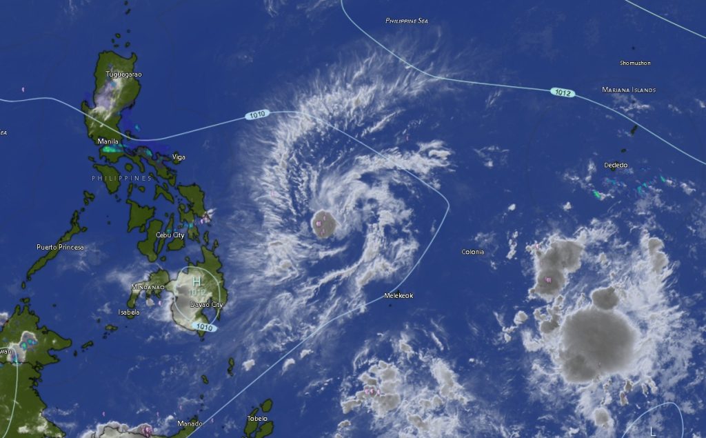
In its Regional Weather Forecast for Mindanao issued at 5:00 a.m. on May 12, PAGASA said the center of Tropical Depression “Caloy” was estimated at 480 kilometers east of Guiuan, Eastern Samar as of 3:00 p.m. yesterday. The weather disturbance was packing maximum sustained winds of 45 kilometers per hour near the center and gustiness of up to 55 kilometers per hour while moving northward at 10 kilometers per hour.
According to PAGASA, the trough or extension of Tropical Depression “Caloy” is directly affecting parts of northeastern Mindanao, particularly the provinces of Dinagat Islands and Surigao del Norte, where cloudy skies with scattered rains and thunderstorms are expected throughout the forecast period.
State weather forecasters warned that moderate to at times heavy rainfall may trigger flash floods and landslides in low-lying and mountainous areas, especially in vulnerable communities in the Caraga Region.
Surigao del Norte and Dinagat Islands are expected to experience persistent cloudy conditions accompanied by rain showers and thunderstorms from Tuesday morning until Wednesday morning, with temperatures ranging from 25°C to 32°C. Winds in these areas will be light to moderate coming from the northeast to northwest, while coastal waters will remain slight to moderate with wave heights reaching up to 2.1 meters.
Meanwhile, the rest of Mindanao, including Northern Mindanao, Zamboanga Peninsula, Davao Region, SOCCSKSARGEN, and the Bangsamoro Autonomous Region in Muslim Mindanao (BARMM), will generally experience partly cloudy to cloudy skies with isolated rain showers or localized thunderstorms.
PAGASA emphasized that despite generally fair weather in many areas, severe thunderstorms could still bring sudden heavy downpours that may cause flash floods or landslides.
In Northern Mindanao, provinces such as Bukidnon, Camiguin, Lanao del Norte, Misamis Occidental, and Misamis Oriental are expected to have intermittent rain showers and thunderstorms with temperatures ranging from 20°C to 34°C.
The Davao Region, including Metro Davao, Davao del Norte, Davao del Sur, Davao Oriental, Davao de Oro, and Davao Occidental, will also experience partly cloudy to cloudy skies with possible thunderstorms. Temperatures in the region may reach up to 34°C.
In SOCCSKSARGEN, North Cotabato and South Cotabato are forecast to experience some of the highest daytime temperatures in Mindanao, ranging from 25°C to 35°C, while Sultan Kudarat could reach as high as 36°C under humid conditions.
The Zamboanga Peninsula, including Zamboanga City, Zamboanga del Norte, Zamboanga del Sur, Zamboanga Sibugay, and Isabela City, will continue to experience warm weather conditions with isolated thunderstorms and temperatures ranging from 24°C to 34°C.
In BARMM, provinces including Basilan, Sulu, Tawi-Tawi, Maguindanao del Norte, Maguindanao del Sur, and Lanao del Sur are also expected to have isolated rain showers and thunderstorms with generally light to moderate winds and slight to moderate sea conditions.
PAGASA advised residents, especially those living near rivers, coastal areas, and landslide-prone communities, to remain vigilant and continue monitoring official weather bulletins as Tropical Depression “Caloy” continues to influence weather conditions over Mindanao.
Fisherfolk and small sea vessels traversing the northeastern seaboards of Mindanao were likewise advised to exercise caution due to moderate sea conditions caused by the tropical depression’s trough.
For updates and emergency weather advisories, the public may visit PAGASA Official Website.