
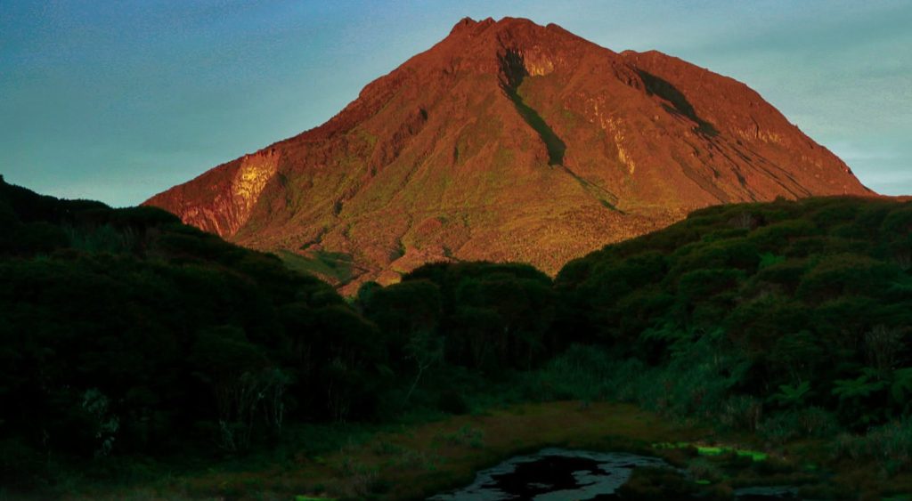
For generations, Mount Apo has stood as one of the Philippines’ most enduring natural icons.
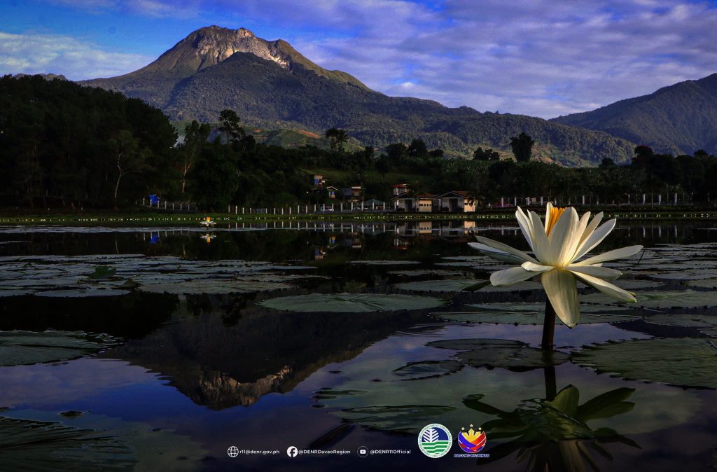
Rising above the landscapes of Mindanao, the mountain is widely known as the “Father of Philippine Mountains” and is recognized as the country’s highest peak. Its moss-covered forests, enormous trees, rare wildlife, cool mountain streams, and rugged trails have made it a destination for climbers, scientists, conservationists, and communities whose lives are deeply connected to its slopes.
But Mount Apo is far more than a summit to be conquered.
Beneath its forests and along its difficult trails lies another dimension of the mountain that is only beginning to receive the attention it deserves: its extraordinary geological heritage.
Long before Mount Apo became a destination for trekkers, its landscape was being shaped by immense geological forces. Volcanic activity, eruptions, uplift, collapse, weathering, and erosion gradually transformed the mountain into the complex landscape seen today.
Its crater lakes, geothermal fields, waterfalls and volcanic formations are not merely scenic attractions. They are pieces of a geological story stretching back hundreds of thousands of years—a story that continues to influence the ecosystems, cultures, and communities surrounding the mountain.
A Mountain Built by Fire and Shaped by Time
Mount Apo’s present-day landscape is the product of processes that operated on a scale far beyond human lifetimes.
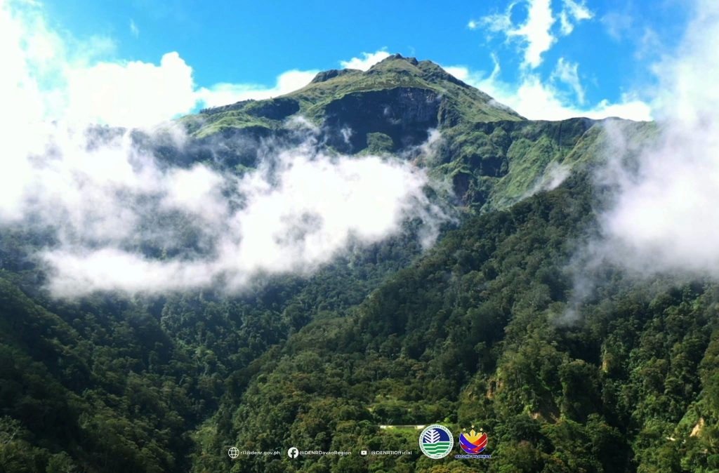
Volcanic activity created and reshaped portions of the mountain, while subsequent erosion and other geological processes carved its slopes and exposed features formed during its fiery past.
The result is a landscape where evidence of volcanism can still be encountered in remarkably tangible forms.
In one area, water occupies an ancient volcanic depression. Elsewhere, steam and gases escape from the earth. Waterfalls plunge through rugged terrain, while distinctive volcanic landforms provide clues about the forces that once dominated the region.
These features collectively transform Mount Apo into something more than a biological sanctuary. They make it a natural archive of Earth’s geological history.
For visitors, this means that every trail can tell a different story.
A climb toward the mountain’s upper reaches is not simply a journey through changing vegetation zones. It is also a passage through landscapes created by geological forces that helped determine where forests developed, where water accumulated, and where communities eventually established their homes.
Forty-Three Geosites Tell the Mountain’s Story
The geological significance of Mount Apo has become increasingly apparent through the documentation of 43 geosites across the mountain landscape.
Among the identified sites are Lake Jordan, Pabudsaran Waterfalls, Lake Agco, Lake Maag, and the Mandangan Solfataras.
Each represents a different expression of the mountain’s geological character.
Crater lakes provide evidence of the volcanic processes that shaped the terrain. Waterfalls demonstrate how water continues to carve and reshape the landscape. Geothermal features reveal that the Earth’s heat remains detectable beneath the surface.
Together, these sites create a geological mosaic that helps explain how Mount Apo developed into the mountain that dominates the surrounding landscape.
The significance of these places therefore extends beyond their visual appeal.
They are geosites—places where geological features, processes, and history can be observed and understood.
Protecting them means protecting the physical evidence that allows future generations to understand the origins and evolution of one of the country’s most important natural landscapes.
Lake Jordan and the Memory of Ancient Volcanism
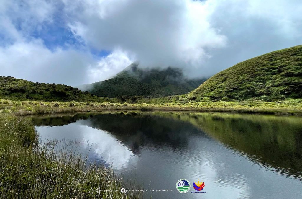
Among Mount Apo’s documented geological features are its crater lakes, including Lake Jordan.
Such bodies of water are more than tranquil mountain destinations. Their existence is closely connected to the volcanic history of the landscape.
Over geological time, volcanic depressions can become natural basins where water accumulates, creating ecosystems that are themselves shaped by the surrounding geology.
The relationship between geology and biology becomes particularly evident in places like these.
The rock and landform determine where water collects. Water determines which organisms can survive. Vegetation develops around the lake, wildlife finds habitat, and people attach cultural and practical value to the landscape.
In this way, a geological event that occurred long before modern communities existed can continue to influence life today.
Where the Mountain Breathes: Mandangan Solfataras
Perhaps nowhere is Mount Apo’s volcanic identity more apparent than in its geothermal features.
The Mandangan Solfataras are among the documented geosites, offering a visible reminder that Mount Apo’s geological story is not entirely confined to the distant past.
Solfataras are areas where volcanic gases and steam escape through openings in the Earth’s surface. They represent the interaction between underground heat, rocks, water, and gases.
For scientists and visitors alike, such features provide a rare opportunity to witness geological processes that are normally hidden beneath the ground.
The steam rising from the earth is therefore more than an unusual mountain spectacle.
It is a reminder that Mount Apo’s identity as a volcanic landscape remains written into its physical environment.
Waterfalls as Geological Storytellers
Water has also played a powerful role in shaping Mount Apo.
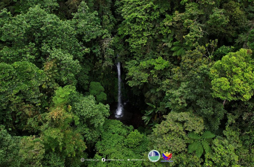
Among the documented geosites is Pabudsaran Waterfalls, where flowing water demonstrates another fundamental geological process: erosion.
Over long periods, streams and rivers cut through rock and soil, transporting sediments and reshaping valleys and slopes.
A waterfall may appear to be a purely scenic feature to a casual visitor, but geologically it is part of an ongoing process.
Every drop of water contributes, however slowly, to the continued transformation of the landscape.
This makes Mount Apo a rare kind of natural classroom—one where geological processes can be seen not only in ancient formations but also in processes that continue today.
Lake Agco and the Intersection of Geology and Community
Another important geosite is Lake Agco, an area known for its geothermal character and its connection to the communities around Mount Apo.
Places such as Lake Agco demonstrate how geological heritage and human life are inseparable in landscapes like Mount Apo.
The mountain is not an isolated wilderness existing apart from society. Indigenous peoples and other communities have developed relationships with its forests, rivers, volcanic features, and surrounding lands over generations.
The geological environment influences water systems, soil, vegetation, livelihoods, tourism, and cultural practices.
For communities living around Mount Apo, therefore, conservation is not simply about protecting rocks and landforms.
It is about protecting the ecological and physical foundations upon which life depends.
A Geo-Bio-Cultural Landscape
This is what makes Mount Apo particularly significant.
Its geology cannot be separated from its biodiversity.
The mountain’s volcanic history helped create the terrain upon which forests developed. The forests regulate water. Rivers flow through geological formations. Wildlife occupies habitats shaped by elevation, climate, soils, and landforms. Human communities interact with these resources and develop cultural relationships with the landscape.
Mount Apo is consequently better understood as a geo-bio-cultural landscape—a place where geology, biodiversity, and human culture exist in an interconnected system.
Its geological heritage provides the foundation.
Its biodiversity represents the life that evolved and adapted upon that foundation.
And its communities represent generations of human relationships with the mountain.
Destroying any one element can affect the others.
A geological feature damaged by inappropriate development may no longer retain its scientific or cultural value. Forest degradation can alter water systems and accelerate erosion. Changes to watersheds can affect communities downstream.
Conservation, therefore, must look beyond individual species or isolated attractions.
It must protect the entire landscape and the relationships that make it unique.
From Mountain to Geopark
This broader understanding is at the heart of Mount Apo’s bid for recognition as a UNESCO Global Geopark.
The initiative, being pursued with the involvement of the Department of Environment and Natural Resources (DENR), represents an effort to elevate the importance of Mount Apo’s geological heritage alongside its already recognized ecological and cultural values.
The concept of a geopark goes beyond simply placing a prestigious designation on a landscape.
It emphasizes the protection and interpretation of geological heritage while promoting education, sustainable tourism, scientific research, and community participation.
For Mount Apo, such recognition could provide a framework for telling a more complete story about the mountain.
The story would no longer begin and end with its status as the Philippines’ highest peak.
Instead, visitors could learn how volcanic processes created the landscape, how geological forces influenced ecosystems, how Indigenous and local communities developed relationships with the mountain, and why protecting its natural systems is essential to the future.
Conservation Beyond the Forest
Mount Apo’s biodiversity has understandably dominated conservation discussions for decades.
Its forests provide habitat for an extraordinary range of species, while its watersheds support communities far beyond the mountain itself.
But conservation that focuses exclusively on living organisms risks overlooking the geological foundations that make these ecosystems possible.
A forest can regenerate.
A damaged geological formation, however, may take millions of years to form again—or may never be recreated at all.
That distinction gives geoconservation particular importance.
Protecting Mount Apo’s geosites means ensuring that future generations can still see, study, and appreciate the physical evidence of the mountain’s formation.
It also means managing tourism carefully.
As Mount Apo attracts more visitors, trails, campsites, waterfalls, geothermal areas, crater lakes, and other attractions can face increasing pressure. Without responsible management, the very features drawing visitors to the mountain can become vulnerable to degradation.
A geopark approach can help shift tourism from simple sightseeing toward geotourism—travel that encourages visitors to understand, respect, and help conserve the geological, ecological, and cultural character of a place.
For the People Who Call Mount Apo Home
Yet perhaps the most important dimension of Mount Apo’s conservation story is the people who live around it.
To an outsider, Mount Apo may be a spectacular destination marked on a trekking map.
To communities, it can be something much more fundamental.
It can be a source of water, food, livelihood, cultural identity, spiritual significance, and ancestral connection.
For Indigenous communities in particular, the mountain is not merely a collection of geological formations and biodiversity statistics. It is part of a living cultural landscape.
That means conservation cannot be imposed solely from outside.
The people who have lived with the mountain and depended upon it must have a meaningful role in determining how its natural and cultural heritage is protected and presented.
The success of any geopark initiative will therefore depend not only on scientific documentation and government action but also on community ownership and participation.
The mountain’s future must ultimately be connected to the future of the people who depend on it.
A Legacy Written in Stone
Mount Apo has survived geological forces that dwarf the human imagination.
Volcanoes built landscapes. Heat moved beneath the earth. Water carved through rock. Forests emerged and disappeared. Species adapted. Human communities eventually made the mountain part of their lives.
And through all of it, the landscape continued to change.
The 43 documented geosites provide only a window into that long story, but they reveal why Mount Apo deserves to be understood in a much broader way.
It is not simply the Philippines’ highest mountain.
It is a record of volcanic history, a reservoir of biodiversity, a source of water, a cultural landscape, a scientific laboratory, and a home.
Its crater lakes preserve traces of ancient geological processes. Its waterfalls demonstrate the continuing power of erosion. Its geothermal areas reveal the heat beneath the surface. Its forests and wildlife show how life has occupied and adapted to the landscape.
Together, they tell a story that no single summit photograph can capture.
More Than a UNESCO Bid
The push for UNESCO Global Geopark recognition is therefore about more than securing another international designation.
It is an opportunity to change how Mount Apo is understood.
A mountain should not have to be climbed to be valued.
Its rocks, lakes, forests, rivers, geothermal features, wildlife, and cultural landscapes all carry meaning. Each is part of a larger system that has evolved over immense stretches of time and continues to sustain people today.
The challenge is ensuring that recognition does not become an end in itself.
The real measure of success will be whether the initiative strengthens conservation, supports local communities, encourages responsible tourism, advances scientific and environmental education, and ensures that Mount Apo’s geological and biological heritage remains intact.
Because the greatest achievement would not simply be seeing Mount Apo’s name on a UNESCO list.
It would be ensuring that decades and centuries from now, people can still stand beneath its forests, look across its volcanic landscapes, feel the warmth of its geothermal areas, hear the rush of its waterfalls, and understand the remarkable story written into the mountain itself.
Mount Apo is more than the Father of Philippine Mountains. It is a living testament to the forces that built the Earth—and to the people and ecosystems that continue to call that creation home.